|
|
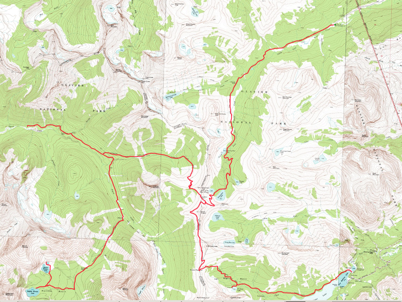
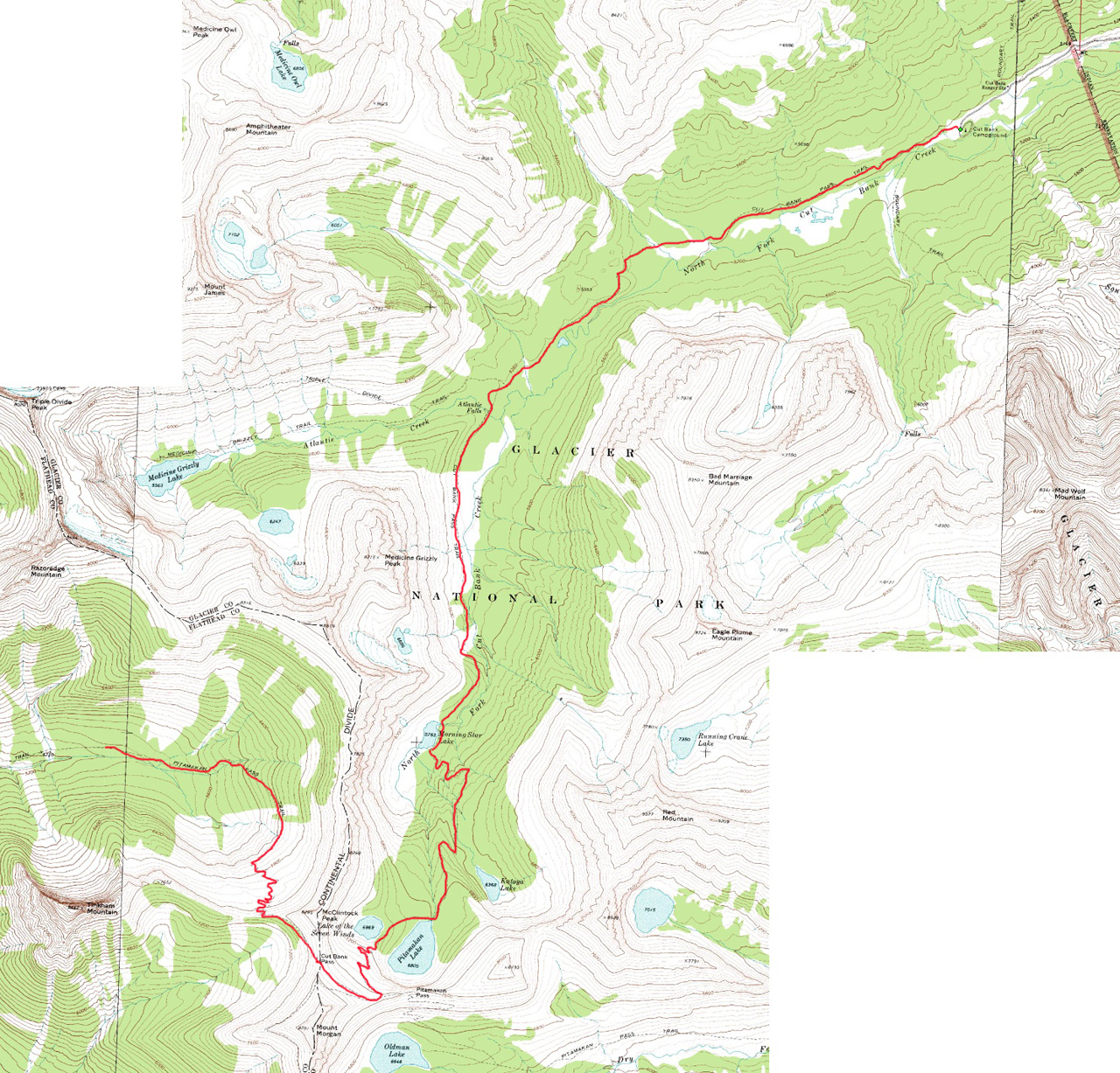
| Map showing route for the entire trip. | Map showing route for Day 6. |
Added 11 November 2005
For maps showing our route click on the following images.
|
|
|
| Map showing route for the entire trip. | Map showing route for Day 6. |
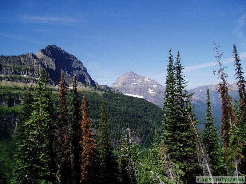
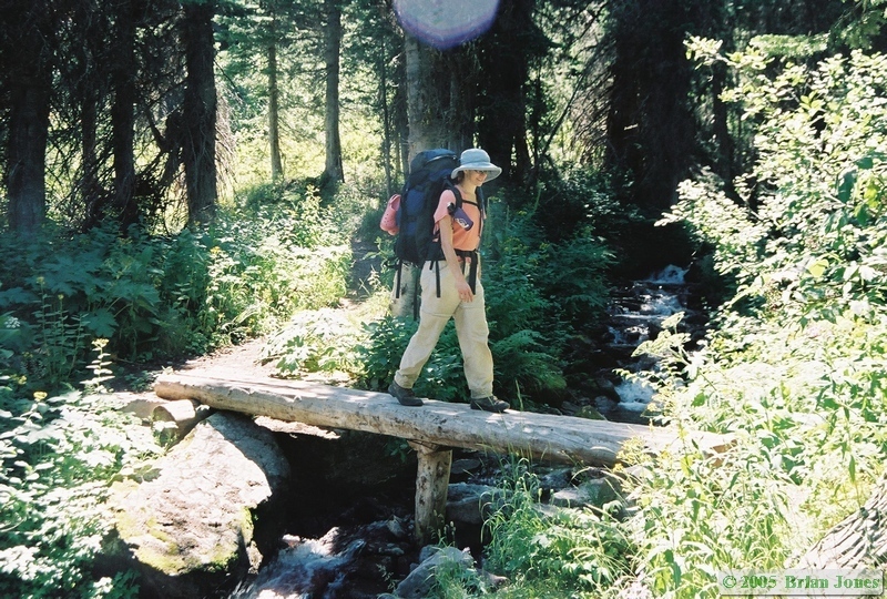
On Thursday, we were looking at a potentially very long day again, with 3500 feet of elevation gain, then the same amount of elevation loss, and over 12 miles of trail. I think we were all a bit apprehensive about the day ahead, so we got up early and really got moving. Worried about how Shan would handle the climb and descent, I took some gear out of her pack and added it to mine. I figure I must have been carrying around 65-70 pounds on my back, quite a bit after having done so many miles already.
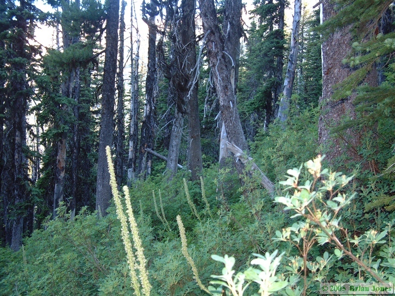 Shan and I were on the trail by about eight o'clock, and climbing fast. I took the photo at left to provide some sense of how steep the trail was. The trail went straight up that slope. No camera tricks either, this photo is aligned with the horizontal plane.
 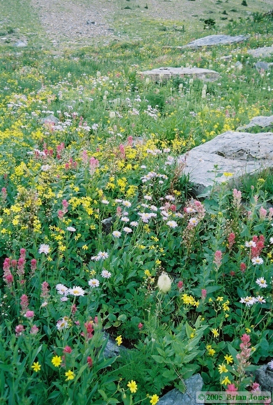 It was a chilly morning and all of the brush was wet, but I opted to start the day in shorts. The first mile or so was somewhat painful as my cold legs were banged and scraped by the brushy trail, but we kept driving on. We were making better time than I could have possibly imagined and I kept encouraging Shan up the mountain by remarking on my genuine amazement at how fast we were going. We were tired when we got there, but we made it the three miles and 3500 vertical feet up to Cut Bank Pass in a little over two hours, far faster than it took us to get down the same incline four days earlier. I was really proud of how fast Shan had made it up the mountain.
|
|
|
NATURAL HISTORY POP QUIZ TIME!!! When did Rana pretiosa get split into two species, Rana pretiosa and Rana luteiventris, with Rana luteiventris existing only east of the Cascades (and in the Glacier area)? You thought I was joking earlier about the quiz, didn't you?!?!? This will teach you to pay attention next time!!
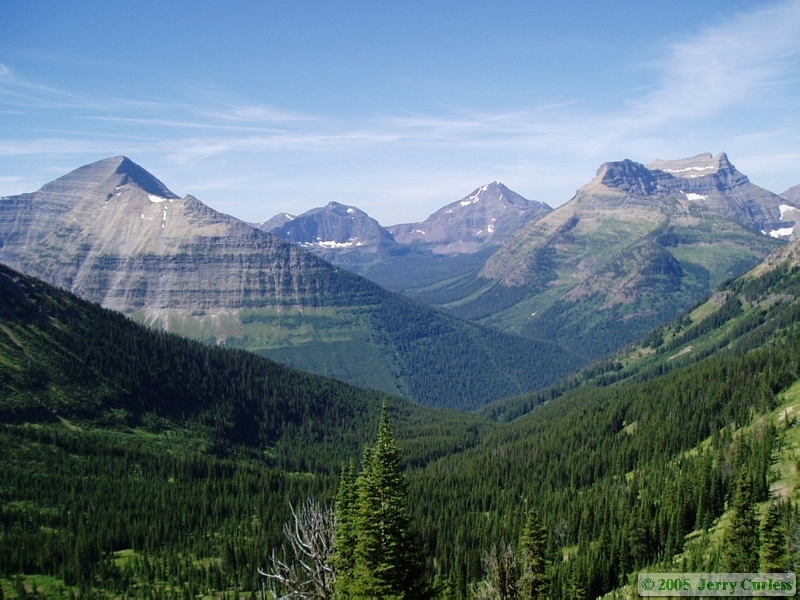
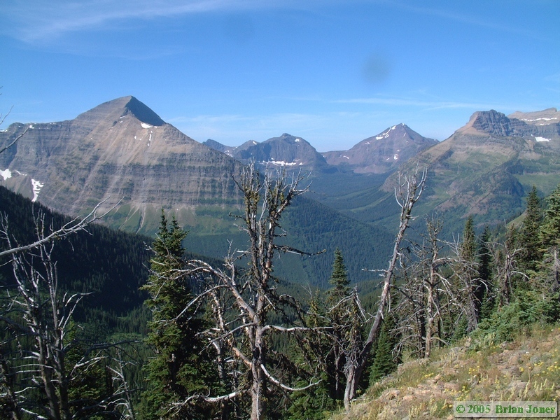
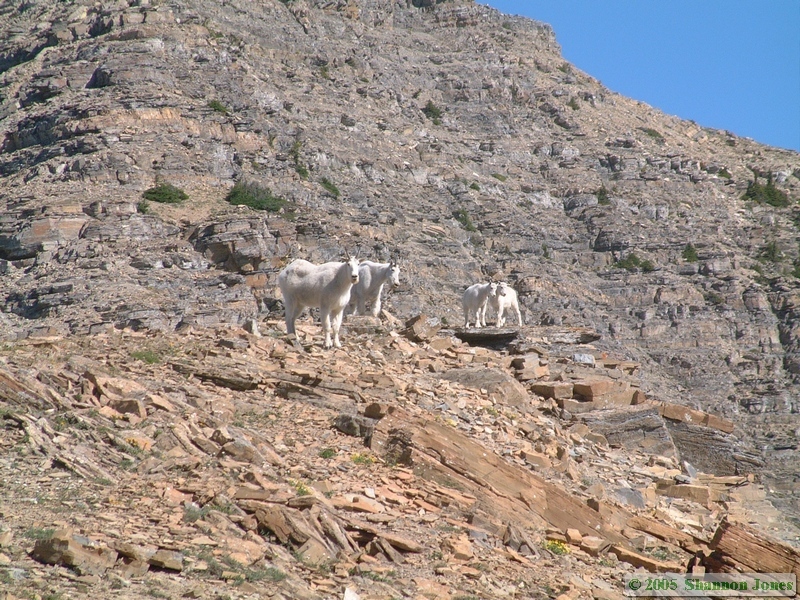
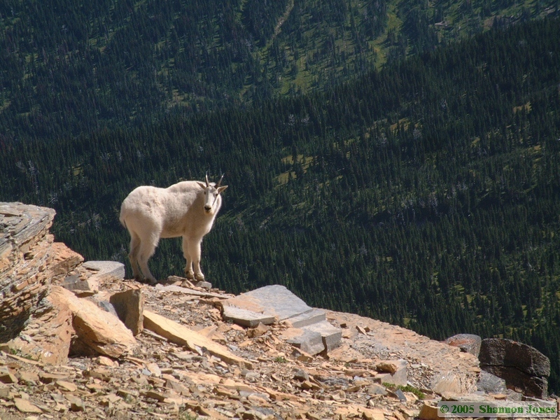
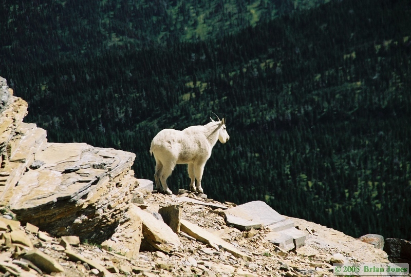
 Since we started out earlier than Jerry and Andrea, we had a fair amount of time at Cut Bank Pass to sit and relax.
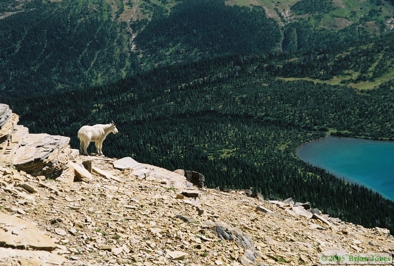
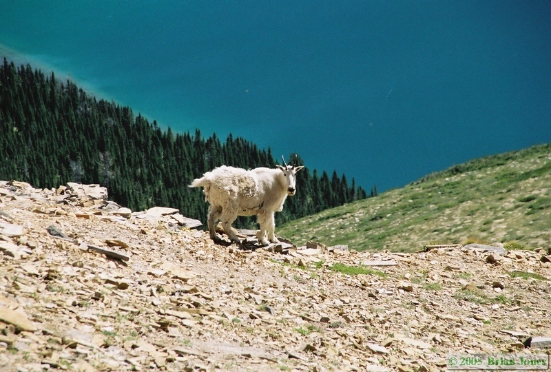
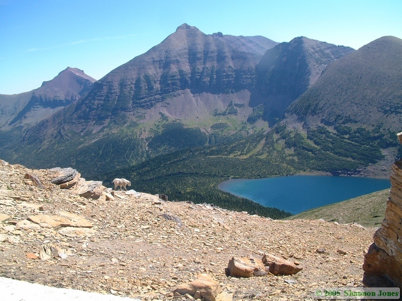
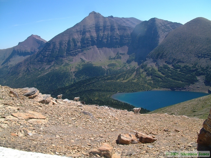
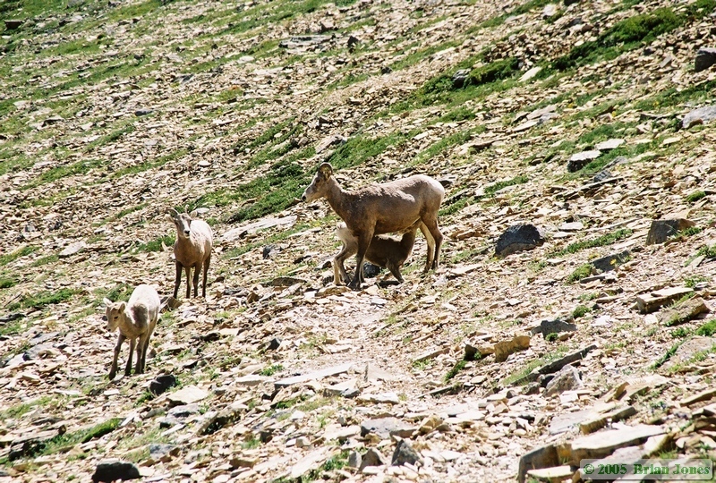
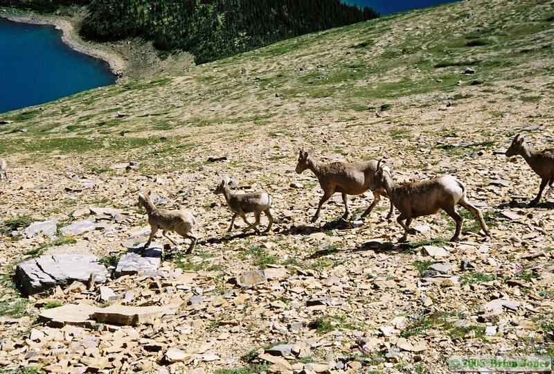
 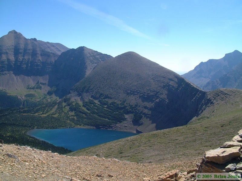 It was during this time that we got a very nice treat. A family of Rocky Mountain Goats (Oreamnus americanus) came over a rise and approached us. The approached over a period of 5-10 minutes and eventually came to within 75 feet or so until my camera started rewinding at the end of the roll and they quickly moved away. When I got up to look over the rock outcropping to try to get more pictures, they were out of range, but it was then that I saw a heard of eleven Bighorn sheep (Ovis canadensis) below! What a blessing!
|
|
|
|
|
|
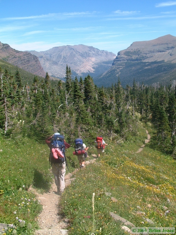
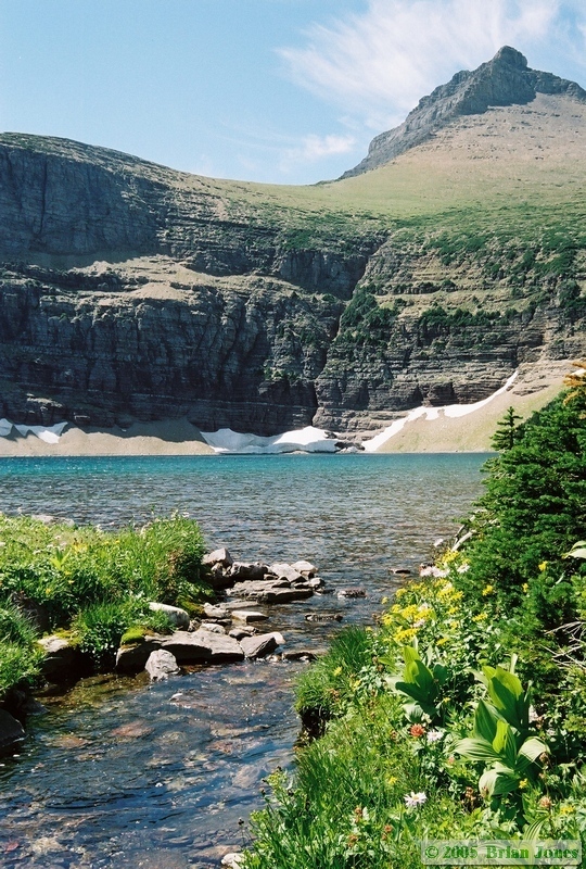
Despite Andrea's badly blistered feet and Jerry's aching feet, they made it up the mountain in roughly the same amount of time as Shan and I. Their feet were in far worse shape than ours, so they continually impressed us with their speed and sticktoitiveness on the trail. When they arrived at Cut Bank Pass, we sat and talked a bit while watching the goats and sheep, then headed down towards Morning Star Lake together. By the time we left Cut Bank Pass, Shan and I were running dangerously low on both film for the SLR and memory for the digital camera, so we didn't get as many pictures as we would have liked of the rest of the trip.
|
|
|
|

|
|
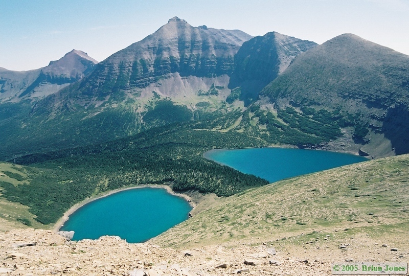
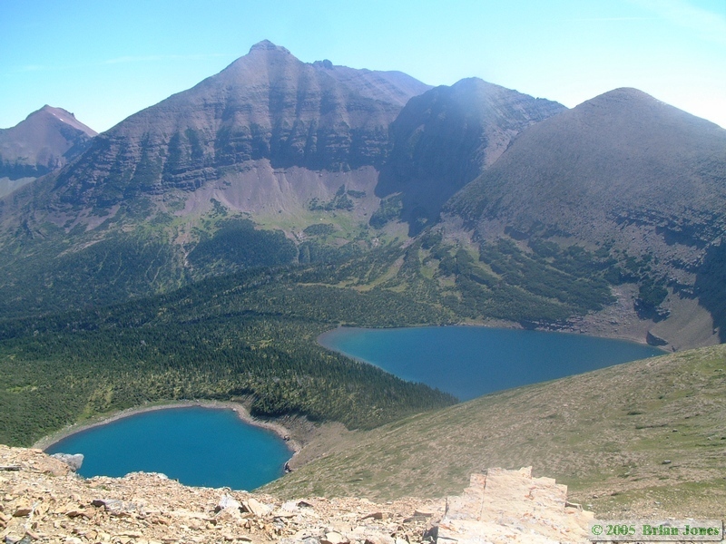
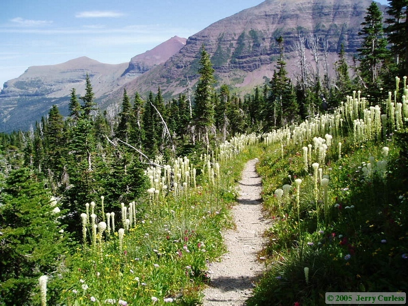
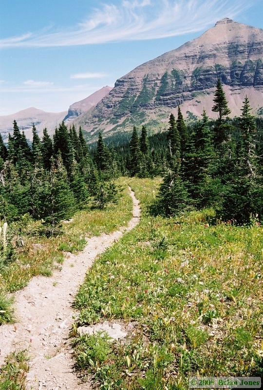
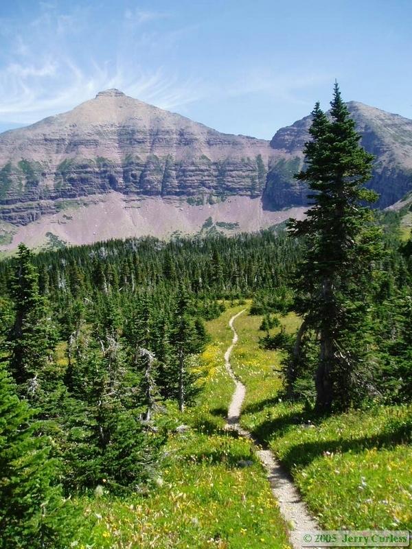
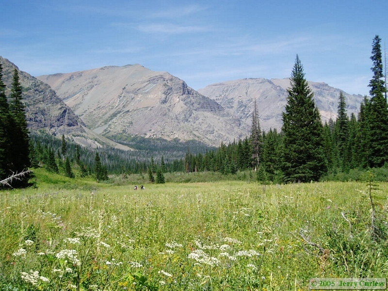
It was nearly all down hill from there in the literal sense, but certainly not in the figurative sense. We descended towards several lakes through fields that were overflowing with a myriad of wildflowers. I didn't count, but estimate that some of the fields must have had at least 20 different species of wildflower gracing them. We hiked amidst this amazing mass of color and beauty in absolute awe and rapture. Hardly 5 minutes would go by before someone would make an awe-filled exclamation of amazement. The condition of the trail had vastly improved as well. They were open, wide, and generally less rocky. Many parts were quite steep though, and the descent took it's toll on knees and feet.
|
|

|
|

|
|
|

|

|
|

|
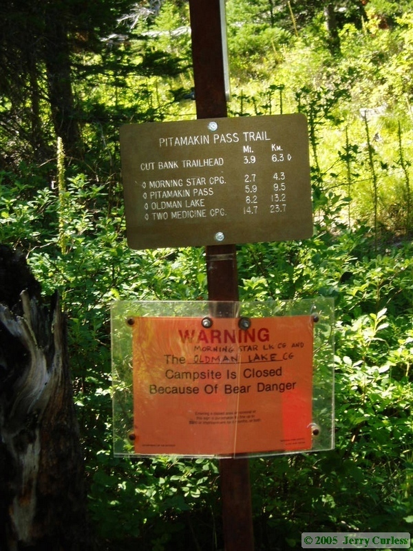
 We stopped for lunch near Morningstar Lake Campground. The campground itself was closed because a momma grizzly bear and her cubs were roaming the area, so we stayed only long enough to eat and filter water. It was then, in the early afternoon sitting by Morningstar Lake, that Jerry said something to the effect of, "You know, I wouldn't complain if we went all the way out today. I could use some recovery time." Knowing Jerry as I do, I was rather shocked that he would suggest leaving early. Shan was definitely interested in a bath and a clean bed, and Andrea was interested in getting off the trail because of her blisters and now swollen knee. I was the only one who wanted to stick with the original plan of staying at Atlantic Creek that night and doing the final four and a half miles of the trip Friday morning, but I remained silent. I knew everyone else would be really happy to exit a day early, and I figured that Shan deserved an early out. From that point on, we kept up a strong pace, with Shan and I taking the lead. The faster pace was better for my knees anyway.
|
|
|
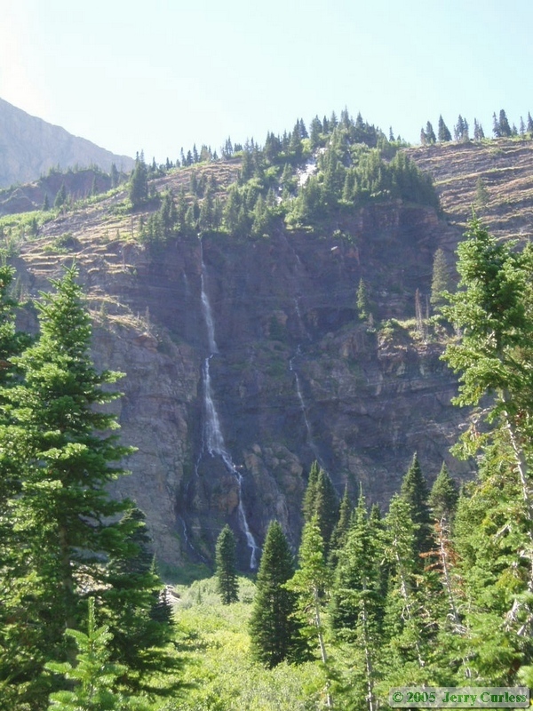
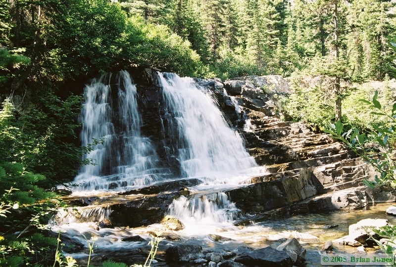 Along the way we stopped briefly at Atlantic Falls, then took a longer break at the trail junction that would either take us to Atlantic Creek Campground or back to our car.
  It was there that we encountered the first human beings we had seen in more than 4 solid days. A young couple were day hiking up to Medicine Grizzly Lake and quickly moved on after reading the trail sign.
 It was a warm afternoon, and Shan and I just wanted to get back to the car at that point, so we went on ahead and really hammered down the trail, stopping briefly several times to either get our hats wet or get our shirts wet to stay cool.
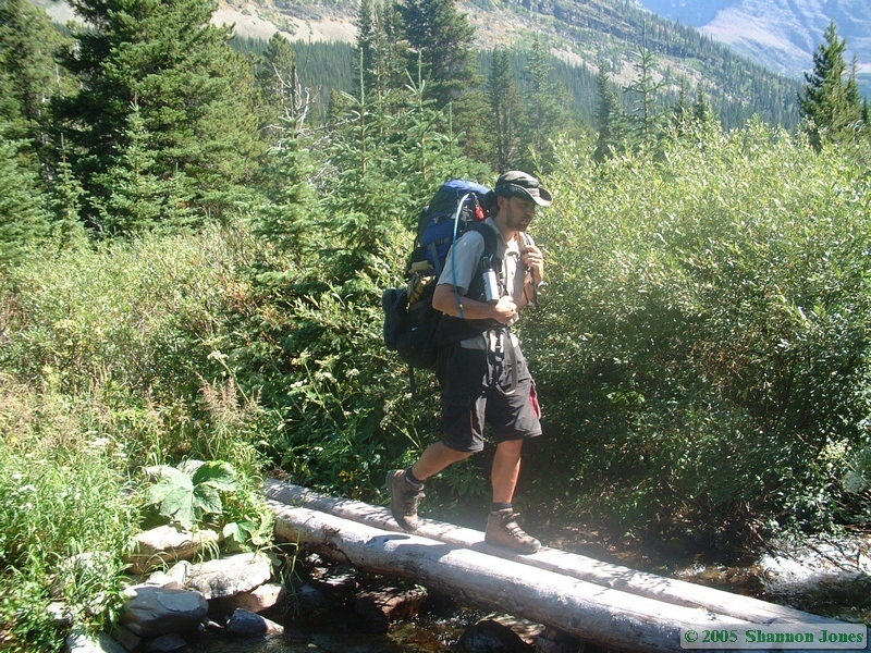
 We made it to the car before five o'clock and quickly got some drinks out of the cooler. They were no longer cold, but they were still refreshing after 8 hours of hiking and about 14-15 solid miles on the trail. Before Jerry and Andrea arrived, I hiked down to Cut Bank Creek and took a little bath. They had just arrived at the car when I got back.

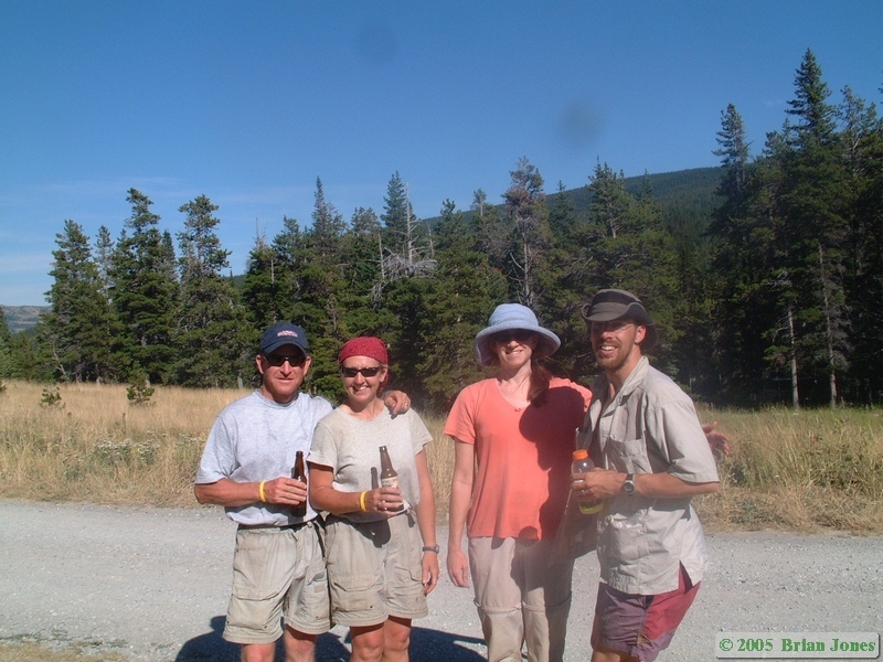 We quickly crammed all of our gear in the car (barely!), took a "We made it!" picture, then I drove us back to Two Medicine Lake and Jerry's truck. Once there, we transferred gear back and forth between the vehicles, then headed to East Glacier for dinner.
It was on during the drive to East Glacier that I think I first noticed that the toes on both of my feet were numb. The numbness was primarily in my toes, but spread into the foot as well. Slowly, to the point of nearly being worrisome, feeling returned to my feet. My feet recovered quickest, my toes last. It took weeks for most of the numbness in my toes to dissipate. I suspect that I simply had some really bad nerve damage from the pounding my feet took under the weight of my 70+ pound pack for so many miles.
The dining options are somewhat limited in East Glacier, and we ended up in a little store that also had a little pizza shop and deli in it. We chatted over dinner and I got the road map out of the car to start charting our course home. We all had some miles to go before stopping for the night, Shan and I down the road and Jerry and Andrea back to their property, so we did linger a great deal over dinner.
Before leaving East Glacier, Shan and I headed over to the East Glacier Lodge to check it out. Like Lake McDonald Lodge, it was a grand place. I wouldn't mind staying at one of the old lodges on a future visit to Glacier. Soon though, we were on the road, reaching for the town of Choteau before stopping for the night. We arrived in Choteau at around 9:30 and quickly settled in to our room, bathed and went to bed. On Friday morning we spent some time getting rid of car and trail trash. and getting the car better organized for our return to Tucson. So it was that we got somewhat of a late start Friday morning.
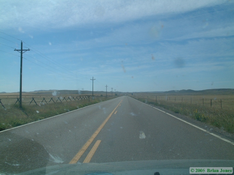 Our drive south was uneventful for the most part. We stopped briefly in Dillon, Montana to check out the Patagonia outlet store. The discounts were pretty good, but prices on most things were still beyond our reach, though Shan did get a $60 travel dress for $9. We made it to Pocatello by dinner time, and Salt Lake City by late evening. On our way south I called my old college friend, Andrea, and arranged to visit her and her family in Peoa, about 30 miles east of Salt Lake City. It was a little after nine o'clock by the time we made it to her place, so we were only able to spend about an hour catching up before we had to head back to Salt Lake and our hotel for the night. It was after eleven by the time we got to our room, and when Shan went to bed I took advantage of the internet café in the lobby of the Crystal Inn to start wading through all of the e-mail I knew was awaiting my return. I was pleasantly surprised to find only about 750 e-mails in my inbox. I expected about twice that. Most of those e-mails of course were spam, so before heading back to the room at around one in the morning, I had whittled my e-mail down to about 60 messages.
We got up at 6:30 Saturday morning and took advantage of the hot breakfast buffet at the hotel before hitting the road at around 8:30. From there it was drive, drive, and more drive. Arizona welcomed us with cooling clouds and eventually some rain. The rest was all uneventful until we reached the Phoenix area where we encountered two rollover accidents, one near multi-car pile-up, and another accident that nearly involved us. I began to think the gods were telling me to get home and stay off the road for a while. By the time we made it to Tucson, we had traveled 3661 miles, quite enough driving for me for a while, thank you very much. We got home at around 8:30 Saturday night, and unloaded the car that night. We didn't bother unpacking bags until Sunday. It was nice to have the extra day on Sunday to relax and catch up on things.
Looking back, both Shannon and I agree that the best day of our trip was the last day of the backpacking trip. The sense of accomplishment, the Rocky Mountain Goats, the Bighorn Sheep, the wildflowers, the lakes, and ultimately the bathing and sleeping in a bed, all helped make it stand out against a backdrop of other wonderful days.
I also have to heap mountains of praise upon my dear wife. Though far more of a princess than a mountain woman, she was a real trooper through some very challenging experiences and she even made it 5 nights without sleeping on a real bed or getting anything other than a sponge bath using 2 cups of water heated over our stove. She definitely had moments where she was near, at, or BEYOND her breaking point, but she kept going. She reached her limits and pushed beyond them. And she came out smelling like a rose (figuratively of course, but definitely NOT literally! :-) Sorry, but I can't let her get TOO big of a head here.), and in the end, despite her early apprehensions and mid-hike panic, she was even glad that she did the trip.
For my part, as I finish this trip report three months after returning from Glacier, I still travel those trails in my mind and scan the horizon with my memories, rapt in awe and contentment. I owe Jerry and Andrea a HUGE debt of gratitude for inviting us to join them. It was an awesome experience. And those two definitely know how to backpack! Their knowledge and tales of the Glacier backcountry made the trip even more enjoyable. So a special thanks goes out to them for making it all happen.
 |
 |
|
|
|