|
|
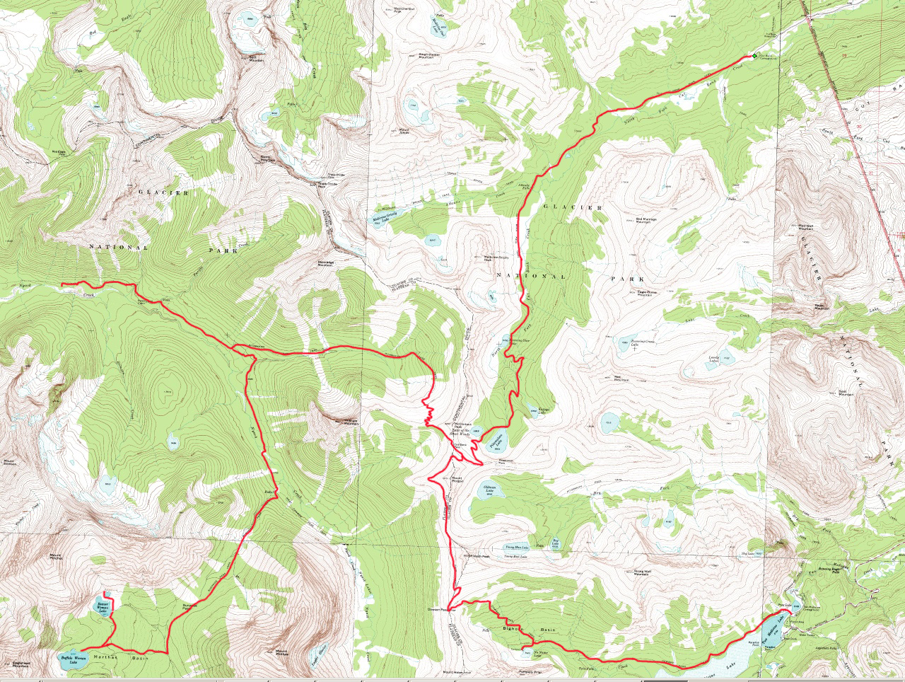
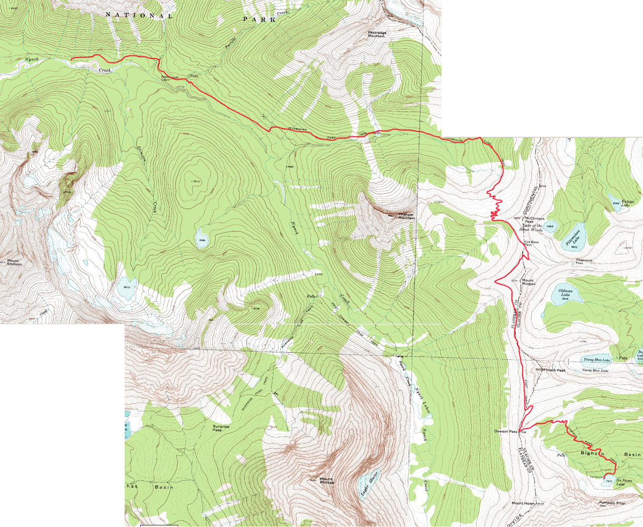
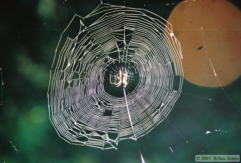
| Map showing route for the entire trip. | Map showing route for Day 2. |
Added 18 September 2005
For maps showing our route click on the following images.
|
|
|
| Map showing route for the entire trip. | Map showing route for Day 2. |
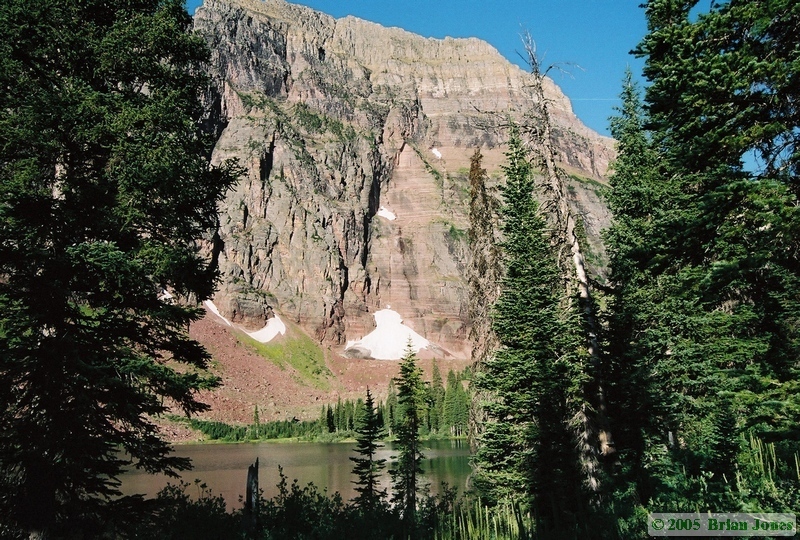
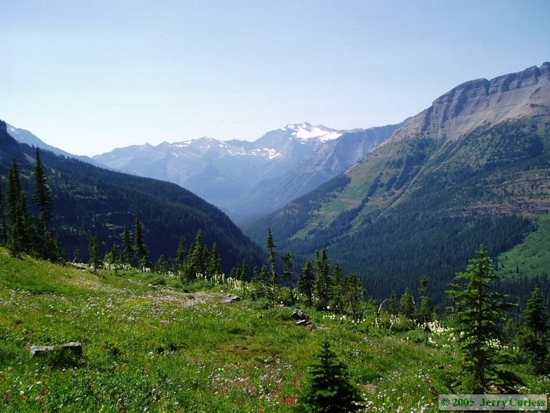
 On Sunday morning, I got up early and walked around to check out No Name Lake. It was a beautiful morning. All in all, we were slow in getting our gear together and didn't hit the trail until around ten o'clock. We would never make the mistake of leaving that late for the rest of the trip.
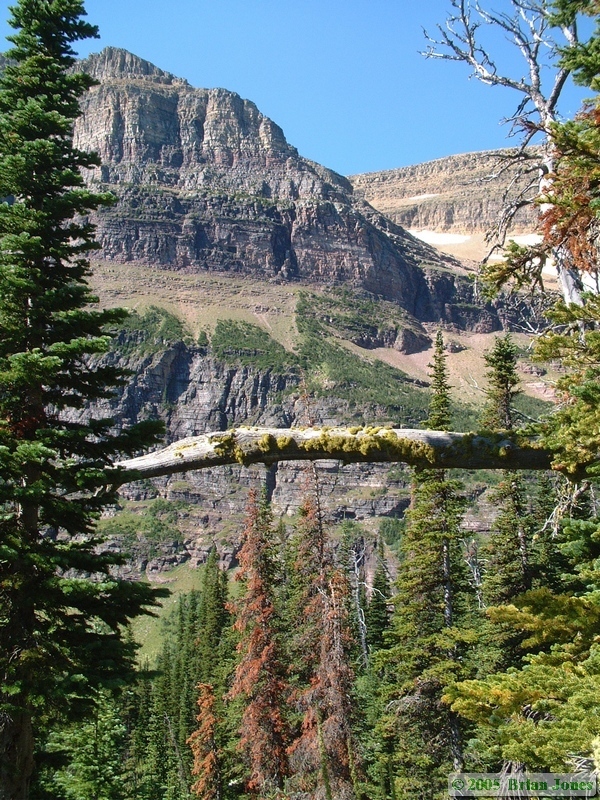
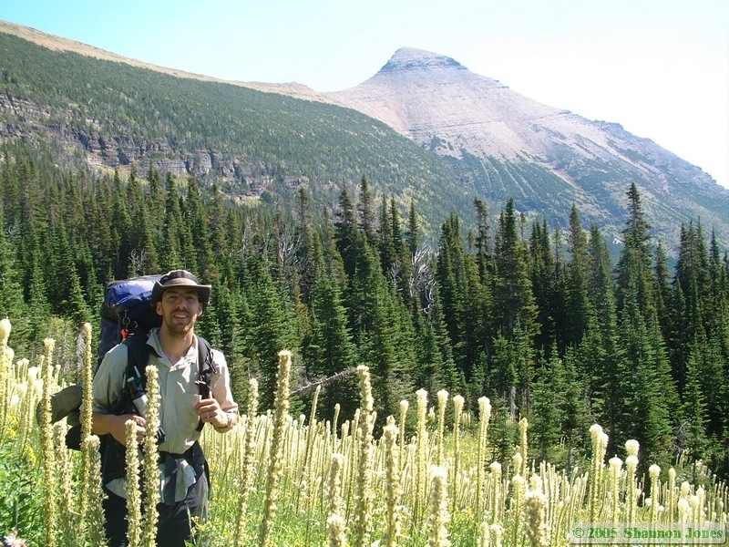
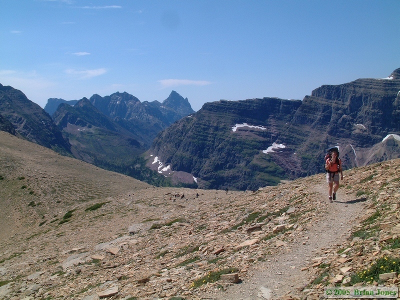
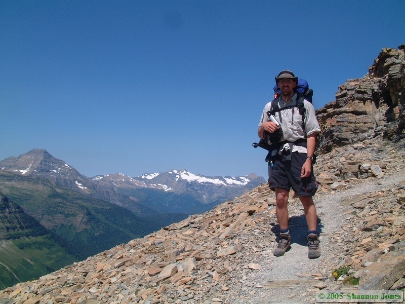
Our first goal was to climb up to Dawson Pass, some 1700 vertical feet over 2 miles. It was pretty steep, and Shan wasn't really prepared for it, so she wasn't a happy camper.
And I'll just leave it at that . . .
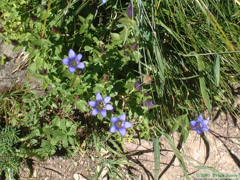
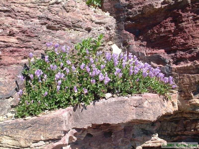
Personally, I thought the climb up, though somewhat strenuous, was also very nice. The views back towards Two Medicine were phenomenal, and the wildflowers were amazing.
|
|
|
|
|
|

|
|
|
By the time we got to Dawson Pass Shan was at her breaking point. I didn't see this, but apparently very near the top where we stopped for a snack break, she picked up a rock, threw it and yelled "Damn!" Quite a serious swear word from her! After she had calmed down a bit, she told me about it and we both got a good laugh out of her little outburst.
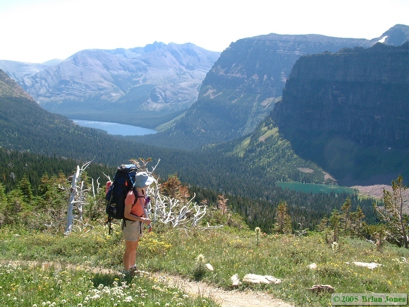
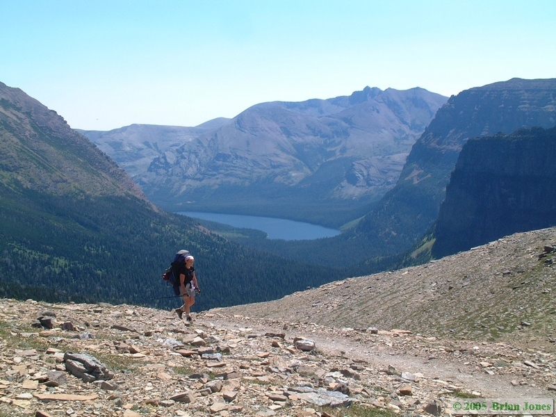
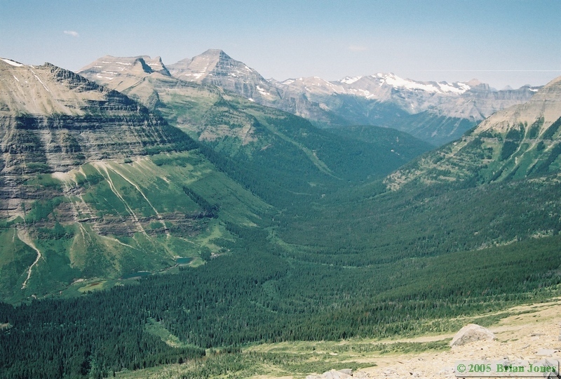
At Dawson Pass is when we first started to experience the high winds that would stay with us for much of the rest of the day as we made the traverse across to Mount Morgan and Cut Bank Pass.
|
|

|
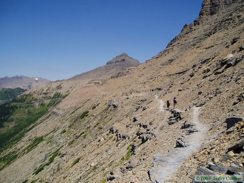 The trail along the traverse was pretty good overall, but there were quite a lot of narrow, loose or sloped sections of trail that, when combined with the really high and gusty winds (I'd estimate 20-50 mph winds), made me worry a little bit about Shan's ability to stay on the mountain. A fall could have easily meant a hundred foot or more tumble down a steep and rocky slope.
 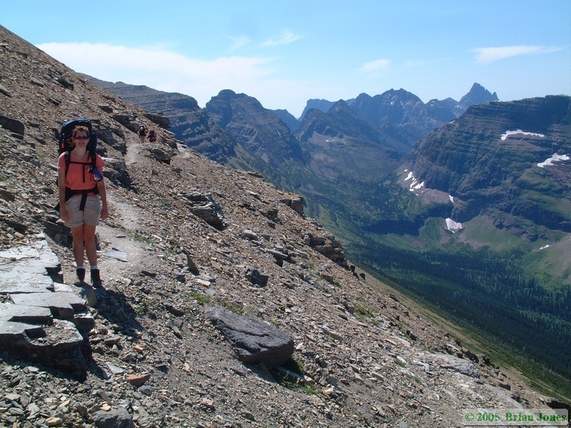 For that reason, it was slow going along the entire length of the traverse. For my part, I enjoyed the fantastic views while pointing out the danger spots and trying to keep Shan focused on the trail.
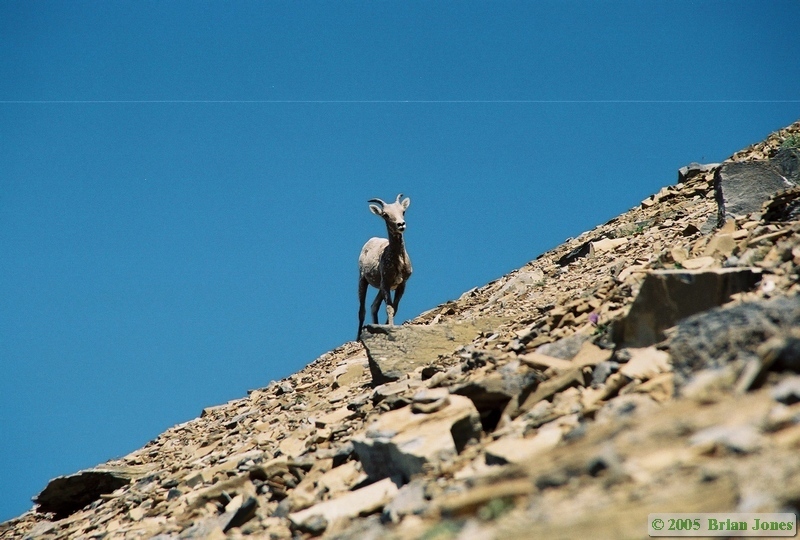
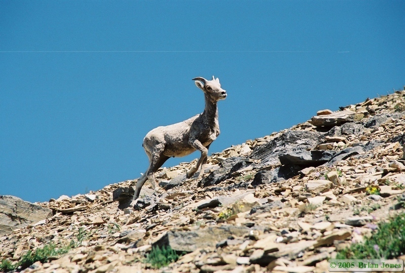
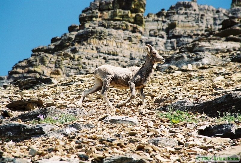
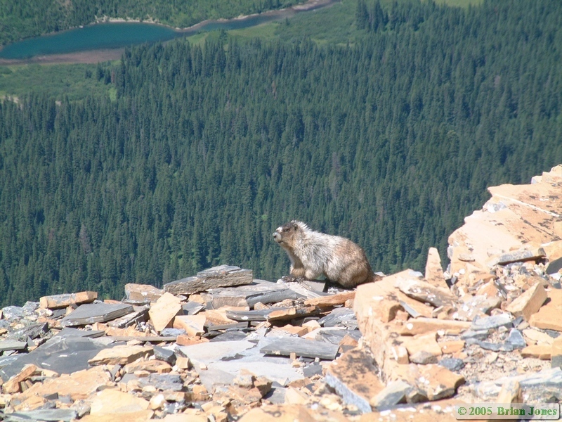 When we stopped for lunch, we were treated to a young, and rather scraggly looking, Bighorn sheep (Ovis canadensis) traveling the opposite direction a mere 75 feet above us. He seemed rather unconcerned about us, and with good reason I suppose. There is no way we could have caught him, even with our packs off. We also saw a couple of species of marmot, including one large Hoary marmot (Marmota caligata). We had seen a lot of day hikers up to this point, but when we left the Hoary marmot, we left other humans behind for a while as well.
|
|
|
At one point we were able to see both east and west from the ridgeline, which afforded us some wonderful views. As we approached Cut Bank Pass, the trail crossed a small snow field. I started across, digging my feet in the snow. 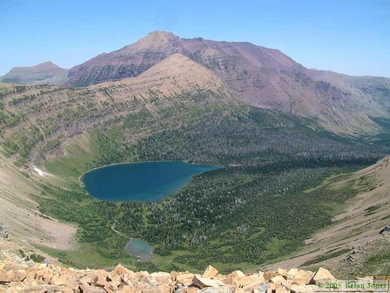 Shan, several feet behind me, didn't make it but one step onto the snow field before she slipped and slid 5-10 feet down the mountain, sliding off the snow and onto the rocks. She had a some cuts and a fairly large bruise from the fall, all of which she handled quite admirably. After that, I took her hand and we dropped down to hike below the snow field. Shan still takes enjoyment out of calling the experience her "ice climbing accident."
By the time we got to Cut Bank Pass it was mid-afternoon and Shan was tired, but we still had about 7 miles and 3500' of mountain to go down. One would think that a descending trail would be a blessing. One would be wrong in assuming this.
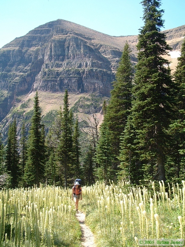
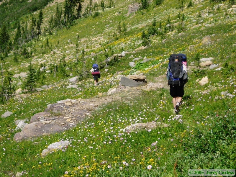
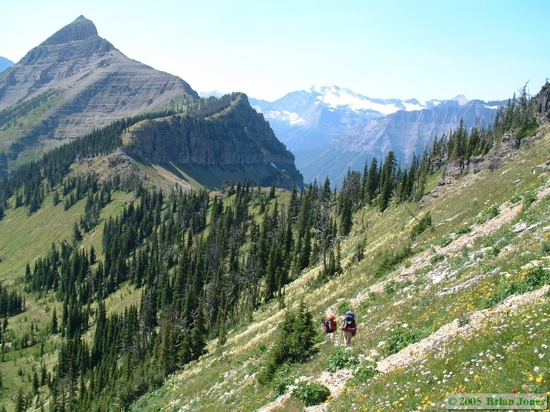 The first half mile or so was absolutely gorgeous, as the trail, though loose and somewhat treacherous, wound through a gorgeous alpine meadow with scores of different species of wildflower.

|
|
|
After that, what we found was that for several miles, the trail went basically straight down the mountain through brush so thick that you could scarcely even see the trail. We were all tired already, and the brutal descent certainly didn't help matters.
You will perhaps note, that from this point forward, there are no more pictures. I didn't take any, which is pretty telling about how we all felt at this point. We were pretty much just putting one foot in front of the other (and hoping they hit stable ground!). I am usually pretty tireless, but even I found myself occasionally having to remind myself to look around and re-center my thinking on the amazing beauty around me. Our shouts of "Hey bear!" and "Hello bear!" turned into "Come and eat me now bear!" and "Get it over with, bear!"
Partially because she couldn't see the trail well, and partially because her legs were so weary, Shan fell perhaps half a dozen times on the way down the mountain. She was in pretty bad shape, and it was a struggle for me to keep her motivated to keep hiking.
But hike we did. And hike. And hike. And hike. As we kept hiking along and yelling for the bears, I used her usually soft bear calls to gauge her mood, as well as her physical and mental condition. It helped me to know when to stop, when to keep her moving, when to give her words of encouragement, and when to give her a hug and kiss her. She was having a really rough day.
It was agreed by all that someone had lied to us, because the hike couldn't possibly have only been 13.6 miles long. It seemed like the day was never going to end. Then we got to the Nyack Creek Trail junction, which meant we still had another 2.6 miles to go! Jerry and Andrea got to the trail junction first, so they hiked on while Shan and I took a break there. It was after seven o'clock at this point, so we couldn't stay long though. We hiked on, passing the patrol cabin on the way to Upper Nyack Creek Campground. Once again, we thought we had been lied to about the distance. We ran out of water perhaps half way to the campground and Shan was really dragging. Thinking we were pretty close to camp, Shan told me to go on ahead and start setting up camp and that she would keep her bear spray in her hand and make a lot of noise. I started hiking briskly but when I had hiked for 10 minutes and no camp appeared, I started into a full jog, thinking that somehow we must have passed the campsite and missed Jerry and Andrea, but not wanting to turn around too soon. Shortly before nine o'clock, I caught up with Jerry and Andrea just as they arrived at the campsite. I still couldn't believe the distance I had just traveled was only 2.6 miles.
I knew I had to go back and get Shan instead of setting up camp, and told Jerry and Andrea that I needed to filter some water for Shan. Instead, they gave me what was left of what they had and I ran back up the trail to find Shan. I got to her earlier than I expected, and probably just in time. I handed the water bottle to her and her shoulders hurt so much she couldn't lift the bottle. We took her pack off and she just crumpled and sat down on the trail, where she drank a little bit of water and rested while I rubbed her shoulders and back. While sitting there, she told me that she had hallucinated that she saw me earlier, but I turned out to be a tree. I wanted to let her rest more, but it wasn't getting any earlier by sitting there, so I took her pack and we walked down to camp.
Shan was pretty much out of it, so I just left her sitting in camp while I filtered water in the fast waning light then got the tent set up. It was dark by the time we made it to the food prep area for dinner, and after midnight by the time we got into the tent. Over dinner, we talked a great deal about our options. Shan really didn't think she could finish the trip and that she was over her head. Our options, as I saw them, were to stay at Upper Nyack one more day and night so she could recover, then either meet up with Jerry and Andrea at Beaver Woman Lake, which we thought was about 12 miles away, or hike out. Shan ended up deciding to save that decision until morning, so that's what we did.
As an interesting aside, we found the pit toilets in the Nyack/Coal Creek Zone to be a bit more primitive than those closer to the front country, in that they are open air. No walls, just a pit covered by a wooden box with a hole cut in it and a lid. No worries about claustrophobia there! I actually thought they were rather nice, as you could watch nature as you did nature's business.
Day two was a LONG day, but was also full of beauty. Mileage: 13.6 (but it felt more like 136).
 |
 |
|
|
|