
Added 28 January 2011
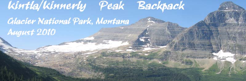
 Wednesday, 18 August 2010, Glacier National Park, Montana

 We started our day out on the established trail to Boulder Pass. Right off the bat we crossed a suspension bridge over Kintla Creek that helped us keep our feet dry.Boulder Pass Trail is extremely scenic and as we climbed we could see across the valley towards our destination for the day, the area below Agassiz Glacier and Kintla and Kinnerly Peaks. It was good to get an overview of the area to help establish our bearings. We would end up needing all the help we could get in that department. (Cue ominous music. Well, cue semi-ominous music, it wasn't that serious.)

|

|

|
There were tons of wildflowers all along the trail. Since the only way I have a chance in Hades of identifying wildflowers is to photograph them and hope to get lucky with my field guides or the internet back at home, I just stayed at the back of the pack and stopped often to photograph each new flower I saw. I actually had a bit more success than usual in identifying things later. Assuming, of course, that I actually ID'd things correctly . . . My favorite was the Pasque flower (Pulsatilla occidentalis), which is shown a handful of rows down on the right. It's part shaggy dog, part Albert Einstein and part, well, a bunch of things.
 along the Boulder Pass trail, Glacier NP")
|
 along the Boulder Pass trail, Glacier NP")
|

|

|

|

|
 |
 |

|

|

|

|

|
 along the Boulder Pass Trail, Glacier NP")
|

|

|

|

|
 along the Boulder Pass Trail, Glacier NP")
|

|
 seed head along the Boulder Pass Trail, Glacier NP")
|

|

|
 along the Boulder Pass Trail, Glacier NP")
|
We left the trail when we reached 7100 feet in elevation then tried to follow the extremely vague description in the Glacier climbing guide.  The terrain was rocky and thickly vegetated and travel through it was a bit of a challenge.
  I even picked up a couple of walking sticks to make the cross-country journey a bit easier and safer. I normally shun hiking poles but I was glad to have them here. The hard part was finding sticks that were comfortable yet could take a lot of abuse.
It wasn’t long before we realized we had missed some important part of the described route, or what passed as a described route. Once ensconsed in the terrain, the route description seemed to be a cruel joke. I suspect that the vegetation has changed fairly significantly since the route was published, because the undergrowth was so thick that we couldn't really see the landmarks it described. Since we didn't know where we went wrong it didn’t make sense to try to find where we departed from the route, so we just kept moving forward as best we could. We ended up above a cliff that we couldn’t descend through, and that kept pushing us to higher elevations as we walked along it, roughly towards our goal.  Due to getting continually diverted slightly from our goal, at around noon we all dropped our packs so Jerry and I could scout ahead and look for the best route. We were unable to find a break in the cliff for quite a ways, but eventually Jerry came to a steep ravine at the base of a snowfield. Though the ravine was steep and rocky it looked doable, but we couldn’t see the bottom and it appeared to me like it might end in a waterfall.
  We went back to report our findings to Andrea and Z, and spent a short while contemplating our options, which were to continue on the high route and go down the ravine, or to backtrack a ways until we could get below the cliff and then traverse across the lower slope. Andrea and Z wanted to do the low route, Jerry wanted to do the high route. I was conflicted, but the greater unknown of the low route eventually made me decide to endorse the high route, albeit half-heartedly. Being the trip leader, Jerry split the tie, surprisingly, by deciding to try the low route. Not far down the mountain Jerry made a comment that he thought we were making a mistake by doing the low route. Z replied that Jerry was the trip leader and if he wants to do the high route we should, but Jerry decided to stick with the low route. It was a decision I can safely say that he came to regret.

|

|
 The descent through the cliff face landed us in an alder thicket so dense that we literally could barely put a foot on bare ground and visibility was minimal.
 ")
 I suspect that vegetation has grown significantly since the climbing guide was written, because the book made the traverse sound like little more than a slightly challenging walk rather than the total body scramble we were doing. We could barely see where we were going or even where we were planting our feet, which in combination with the extremely steep terrain lead to many falls or near falls. I think Jerry and I slipped a couple of times each, Andrea and Z some number more than that. We fought and scratched our way through the thick vegetation for a couple of hours, often forced to travel off course then fight our way back on course. By that time, everyone was basically out of water, and our new goal became finding a stream to replenish our supplies.
")

Given the situation, I pulled out my GPS to verify our location (we couldn’t see past the vegetation to any landmarks) and used it to figure out where we were on the map and try to find the nearest likely water source.  We weren’t far from what appeared would be a fairly reliable brook and we headed for it as best we could. Not long after that we got to the stream and filtered water.My filter was giving me grief, so I bummed some water off of Jerry and Andrea. At that point, Z looked totally beat. Though I suppose we were all pretty tired by then. Even so, and even though I was (half-heartedly) cursing the heavy vegetation, I was enjoying every minute of it. I guess I'm one of the twisted kind that actually enjoys terrain that most would avoid like the plague. Some of my fondest backpacking memories are from some of the most grueling experiences of my life.
 Resupplied with water and re-oriented a bit after my position check, we set out over progressively easier terrain to the base of a cliff band that extended across the entire Agassiz creek valley and created a large, beautiful waterfall. Crossing over the terminal moraine for the glacier, the terrain, though rocky, became essentially level and far more open.
  We had ultimately descended from 7100 feet all the way down to 6000 feet. Our planned high camp was at 7200 feet.
  After assessing the strength of the group, the time, and our potential routes to get to our planned high camp, we decided to camp below the waterfall. That decision made it all but certain that we would only be able to ascend one peak the following day; Kintla, rather than also climbing Kinnerly Peak.
Even though I wore them quite a bit before the trip, it appeared that my newish boots were having a disagreement with one of my feet. At some point along the route today I noticed that my left achilles was starting to hurt pretty bad. The back of the boot was grinding away at my achilles, which grew more and more painful as the day wore on. I was happy to get to camp and put my Crocs on. And I hoped that today was just additional breaking-in that needed to be done and tomorrow would be better.
At this undesignated campsite is where the Bear Vaults we had been lugging around became important. There weren’t any trees tall enough to hang food from, so we had to fit all of our food, trash and other odiferous items into the Bear Vaults we brought. Fortunately, by stuffing ourselves to the gills we were all able to eat enough food to fit everything in, though I think Jerry, Andrea and Z had to leave some cooking supplies outside the Bear Vault tonight (well away from camp).
I wanted to take advantage of the remaining daylight so instead of getting my tent set up right away I hiked up to the base of the waterfall and alternately poked around or just sat and watched it. When I got back to camp, it had been moved because when Z was getting stuff out of his pack his post peak-bagging celebratory beer fell out of his pack and exploded on impact. We couldn’t camp there anymore, so they found a new spot. The new spot was actually much nicer, so it all worked out in the end.

|

|

|

|

|

|

|
 |
By the time I grabbed my pack and brought it to the new location, the others were nearly all set up and preparing to go have dinner. I decided to forego setting my tent up until after dinner so I could have dinner at the same time as everyone else.
The group went to bed after dinner, but I still had quite a bit to do because of my earlier foray to the waterfall. I got my tent set up before dark at least, but all my other tasks occurred after dark. Normally I dislike wind, but I was glad that one kicked up after dark to mask the noise I was making so I didn't disturb the others. It was nice and dark while I filtered water below the waterfall. It was a beautiful evening and it was neat to see the ghostly (but certainly not quiet) waterfall a short distance away. I then wanted to get all of my gear together for the peak ascent the next day, so it was around midnight by the time I went to bed.
 |
 |
|
|
|