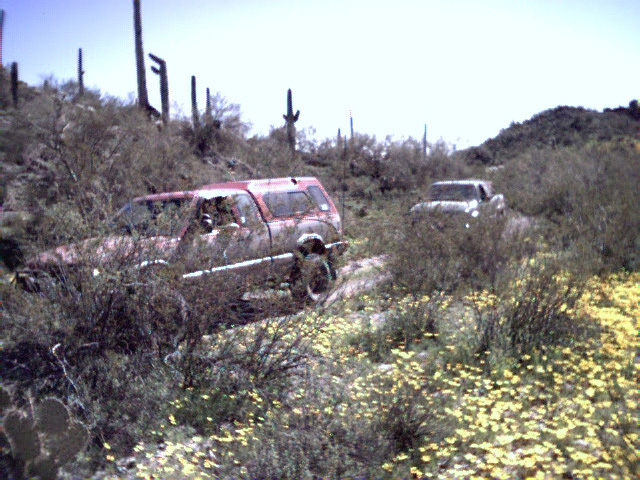
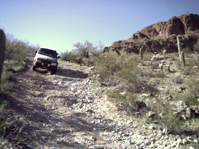
 We nosed our trucks along the floodplain of Greene Wash to the north-eastern base of the range. We skirted the northeastern corner of the range, then at roughly the half-way point down the range, we plunged into the heart of it.
Added 26 February 2001, Revised 2 February 2008
THE DISCLAIMER: With the exception of stock ponds, and the occasional necessity of turning around, I *ALWAYS* drive on established roads and trails. Doing otherwise is not only bad karma, but it leads to ill-will towards four-wheelers/four-wheeling and makes people want to close vehicles out of the beautiful environs that we all enjoy. Please be respectful of private property (don't trespass!) and public lands, as other people want to enjoy them too. Also leave gates as you find them (closed if closed, and open if open.) If a road has a big mud hole in the middle of it, do NOT go around it, as it only makes the road wider, eventually making the mud hole wider. This cycle of foolishness can get out of control. If you can't make it through the puddle, you shouldn't be there. Turn around and find someplace else to explore. TREAD LIGHTLY! For more information on responsible wheeling, go HERE or HERE Ziggy at dirtroad.com says it best, "Use your 4-wheel drive to enjoy the environment, don't use the environment to enjoy your 4-wheel drive!"
Kyle and Ryan met up with myself and Shannon across from the Pilot station off of Exit 208 on the I-10 freeway between Tucson and Phoenix at around 10 am. It was a beautiful day, with a few high clouds and perfect temperatures. We decided that we couldn't have ordered a better day for a little exploring, and after a little chit chat, and introductions of passengers, we headed south on Sunland Road. A right at Harmon road put us in the dirt, and we raced across the desert floor, anxious to get past the farm fields and into the mountains.
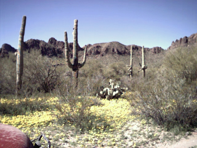
After a couple of miles, we found the corral and gate that would be our dropping off point for the Sawtooth Mountain range and a good place to air down if the mood strikes. The Sawtooth range is small, only 6 miles long and about 1 mile wide, but what it lacks in size, it makes up for in beauty.
We nosed our trucks along the floodplain of Greene Wash to the north-eastern base of the range. We skirted the northeastern corner of the range, then at roughly the half-way point down the range, we plunged into the heart of it.
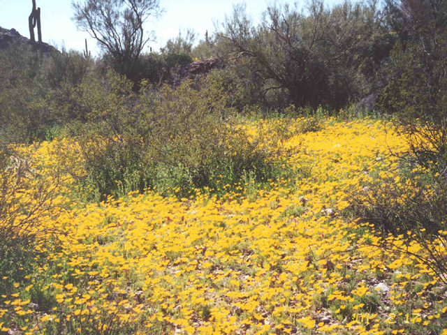
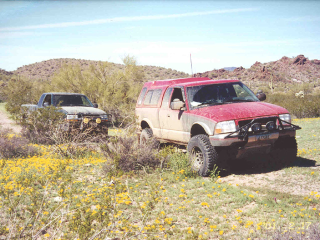
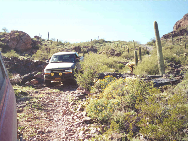
 The terrain was easily navigated in two-wheel drive, but high clearance was helpful. The spring flowers were blooming, and the day was warm enough that even Shannon was riding with her window down. The Sawtooths were rather unpopulated, which added to the small ranges mystique: an untarnished jewel. We went over one of the lower passes in the range, then down the other side, with Casa Grande in full view.
 We weren't going to return to civilization so soon though. A detour on a very seldom used road on the north end of the range would take us around to the back side of the mountains.
We found "it" while on the north end of the Sawtooth Mountains. It started out as a mundane enough discovery, a large, concrete survey marker that would have been visible from the air for aerial photographs or satellite photos. What we couldn't explain was the manhole in one arm of the four-armed concrete marker. It was filled to about 3 feet below ground surface with gravel, and there were a fair number of very real skeletons in the proverbial closet. (Ok, so they were mouse and lizard skeletons, but skeletons nonetheless). A couple of strangely colored living lizards were also found in the hole. Why was the hole partially filled in? Why was it there at all? The questions out-numbered answers.
It wasn't until a few hundred yards down the road that we were able to piece it together. Nuclear. The marker, when viewed from the air, would have looked remarkably like the symbol for a nuclear hazard, except with one extra arm. The extra arm was obviously a government ploy to throw off would be investigators. We kept this information filed away. The next mystery came in the form of a dirt runway in the middle of the desert, with only a few shacks along it. The dirt runway itself wouldn't have meant much, except for the fact that it was nearly two miles long. That is one heck of a runway. Big enough for a large transport carrying secret military supplies! I surmised that one of those shacks was merely the surface structure of an elevator that extended deep into the bowels of the earth . . . [Our suspicions have been confirmed since the trip. None of the pictures of the site turned out. What's going on out there?]
Ok, so my conspiracy theory has been debunked. Apparently it was built as a personal landing strip, but it turns out it was being used to run drugs. I've been warned not to try to land a plane there. There is also a WWII bombing target not far from there to the west. I'm told that you can still find dummy bombs in the target. Of course, maybe the guy who told me all of this works for the CIA and is trying to throw me off their track . . . Hmm . . . Sneaky guys, those government cover-up types.
After realizing that our radio traffic was probably being monitored by the secret government agency that operated the underground base, we decided to continue on quickly to an intended spur destination: an old mining district. After a little bit of confusion, we found the site of a number of smallish excavations, and one somewhat larger excavation. Much of my geology schooling has been lost to the desert heat over the years, but my guess is that gold was the intended find in these obviously unprofitable digs.
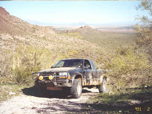
After lunch at the mines, we back-tracked to the "main" road, and continued on around the mountain. Again at roughly half-way down the length of the range, a road took us up and over one of the higher mountain passes. The climb up was pretty easy, but oh what a descent! Steep. Rocky. Loose. Hit the breaks and slide a little bit before stopping. I put my truck in 4-Lo just to have the extra engine breaking on this potentially dangerous drop down the mountain. I'm told this hill was once much much worse and earned the name Widowmaker. Apparently a couple of people have died here.
 |
 |
 |
 As it was, I shifted into 4-Lo, and easily climbed the rest of the way to the top, with Kyle right behind.
We turned around once again and headed down the mountain. The end of the day was near, and we back-tracked to the corral and Harmon road. Just before hitting the Interstate, we pulled into the Pilot for free air. A word of warning, those pumps sure do blow air! I over-inflated my 32's from 20 psi to over 40 psi in no time at all. Made for quick business of hitting the pavement back home.
For more information on the Sawtooth Mountains, try the following links:
http://eebweb.arizona.edu/HERB/SAWPAGES/intro-saw.html
http://eebweb.arizona.edu/HERB/SAWPAGES/
If you're in the Tucson area, drop me a line and we can go wheelin' sometime.

Speaking of which, if you own a Highrider/ZR2/BlaZeR2, or want to find out more about the best little 4X4's around, check out these great sites:
http://www.zr2.com and http://www.zr2hr.org
There is also a ZR2 discussion group, which is very fun for talking about our special trucks and in getting ideas, help, and useful information. I have learned a great deal from the list. You can join by sending an e-mail to mailto:zr2@zr2hr.org with the word "SUBSCRIBE" (without the quotes) in the subject line.
ENJOY!
|
|
|
|